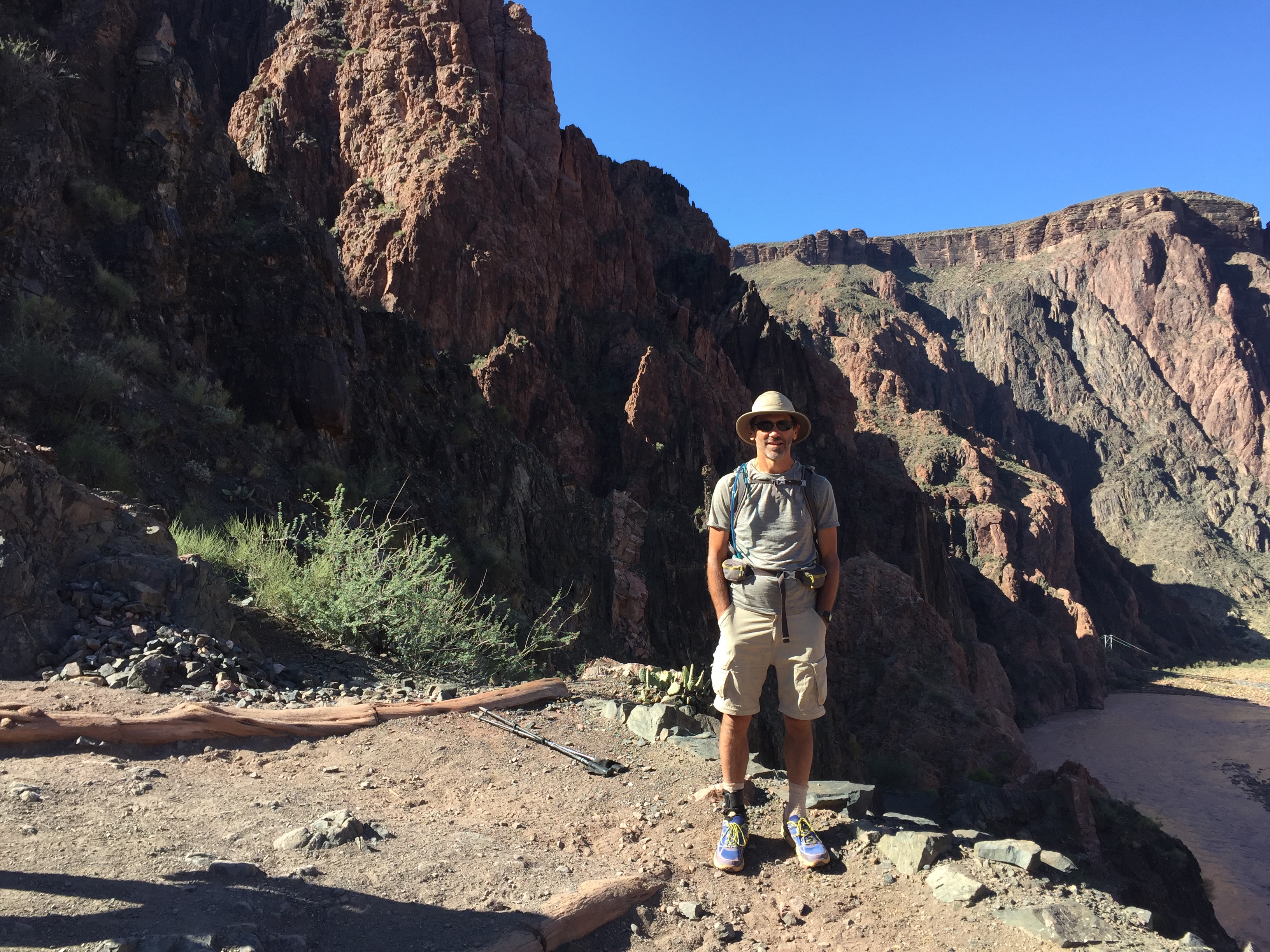
I headed for new territory on this trip, covering several different areas.
Grand Staircase-Escalante National Monument
Burr Trail Road
Burr Trail Road is, well, a road. But I used it as a way to get into hiking areas nearby, including those you see below.
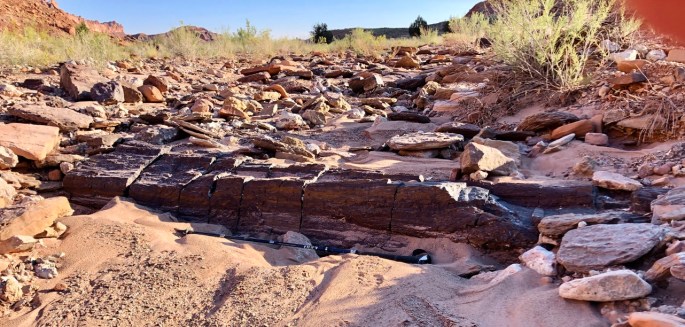
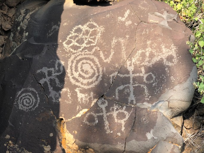
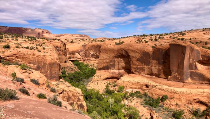
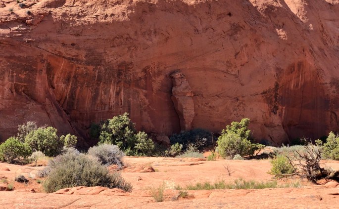
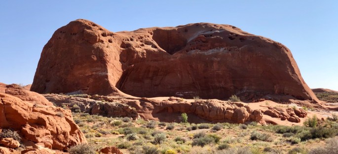
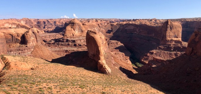
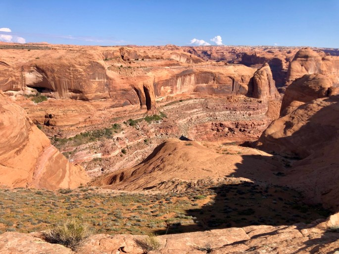
This view from Horse Canyon in Grand Staircase – Escalante National Monument is much like those in other areas of Utah, but I never tire of them.A rather long and broken segment of a petrified tree lies across a wash in Wolverine Petrified Wood Natural Environmental Area of Grand Staircase – Escalante National Monument. (Say that three times.)Hey everyone. Let’s go hiking in Little Death Hollow.The day is just starting. What will it bring?Petrogryphs at Napaweap. it’s all Greek to me.
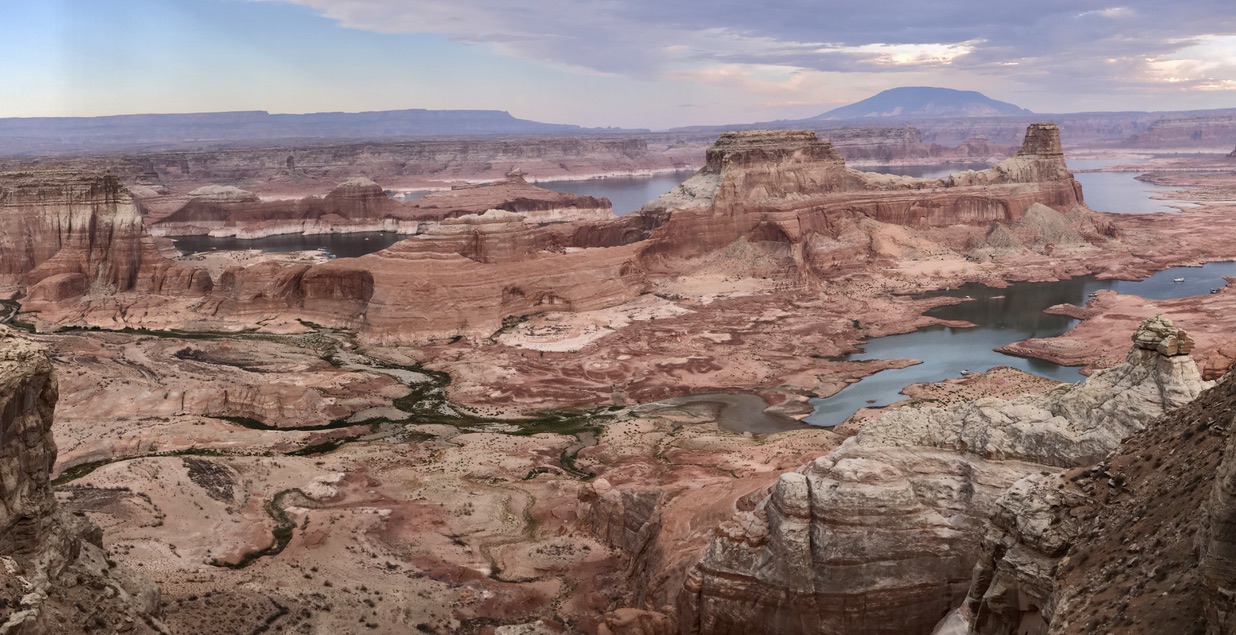
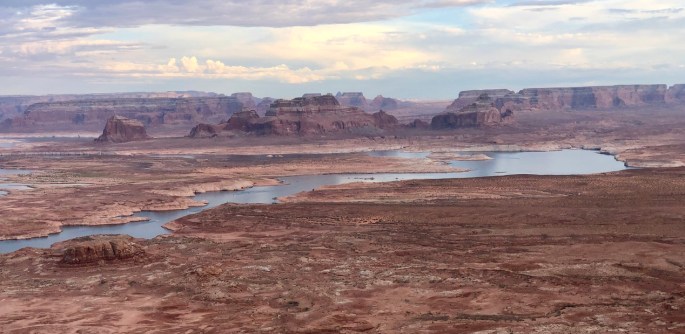
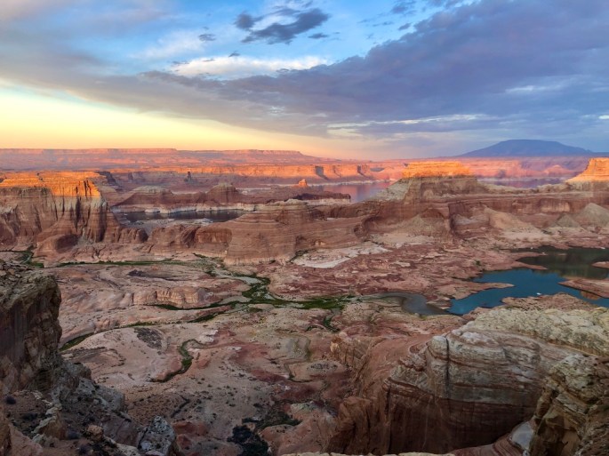
Alstrom Point
Alstrom Point is, well, a point, i.e. a small place on the map, which presumably contains something interesting, in this case spectactular scenery. While it’s located in Glen Canyon National Recreation Area, the road passes through other jurisdictions. Unusual for me, this was a driving trip with no hiking. (Sorry about that.) But the scenery along the way and at the Point was amazing.
This unheralded portion of the drive there thru Glen Canyon NRA was amazing.And it continues for milesI wish I could say that I hiked a zillion miles to this place, but I drove there in only hour from a paved road. And it’s not my destination. Surely, that can’t be better than this, can it?At Alstrom Point, the vistas are very wide, much wider than you can see here.Sunset hastens. Then I can unsee the amazing and rest.When I arrived at Alstrom Point late in the day many of the the best camping spots were taken, of course. But all spots there are great. So this is what I was stuck with. As it happens, this is the approximate site of THE classical shot showing Gunsight Butte. Some bad luck! Unfortunately, the skies were not conducive to a great shot of this incredible, surreal and unforgetable place. Can you believe it gets better than this?
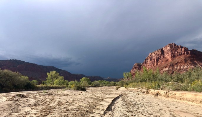
Paria River
On this trip, I visited a section of the Paria River that is north of the more well-known portion of the river, which I visited in Fall 2020.
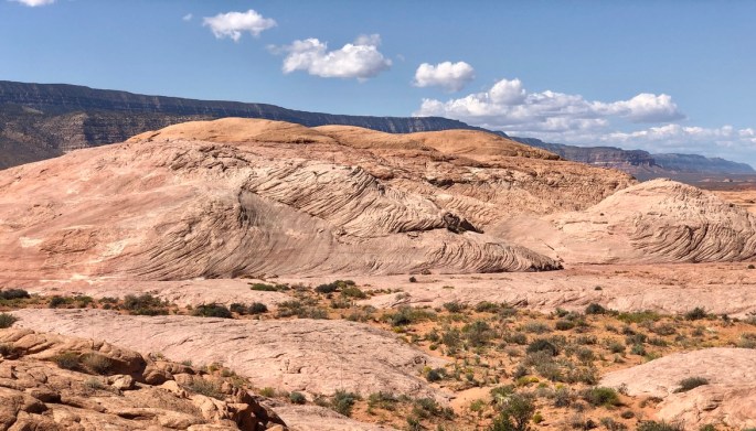
Some of the Wahweap HoodosSpherical rocks?! Actually rock aggregates. Could natural forces produced them? I have never seen such rocks anywhere else.Red rocks always have something new to showThis weather had been following me for an hour while I was on maximum walking speed. There was lightning to the north and south. I don’t know how it happened, but I never got a drop.
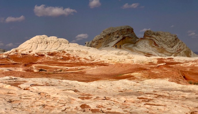
White Pocket
One of most well-known hiking destinations Utah is The Wave in Vermilion Cliffs National Monument. Unrestricted visitation would soon ruin the place, so the BLM has a permit system for visitors. So many people want to get permits that they have a lottery system for entry. Fortunately, for the large majority who can’t get permits, there is White Pocket. It may not be The Wave, but it’s very cool.
You have arrived at White Pocket. But what is it? Those two people make the answer obvious, but what if they weren’t there?While it may seem to be moving and swirling below, it’s just rock. I imagine this could be a scene from someone’s nightmare. I see creatures trying to emerge from roots in the rock. Is that a creepy old woman on the right?White Pocket is actually a rather small area. This view looks beyond it to more of the Vermillion Cliffs National Moument.
Egypt
Along the Hole-in-the-Rock Scenic Backway in Grand Staircase-Escalante National Monument is a place called Egypt. (Technically, although your journey there goes through GSENM, Egypt itself is in Glen Canyon National Recrecation Area. Don’t you just love how complicated it is to describe these places?) It’s another fascinating place in a fascinating state.
Aha! There must be water down below, although not necessarily now.A river runs through the canyonsThe land ahead seems endless, but my time is not. I’d like to return some day if circumstances permit.How could that delicate column have formed? How can it still be standing today?
Hole-in-the-Rock Road
Meanwhile, back along the road, …
If you had access to this place, what would you do with it? Mormon pioneers used it as a dance hall. It’s called Dance Hall Rock.This is the famous Hole in the Rock, where in 1879 Mormon pioneers spent months blasting the upper section in order create a safe pathway to the bottom. In January, 1880, they safely conveyed 83 wagons, 250 people and 1000 head of livestock down slopes of up to 45º in order to reach and cross the river 1200 feet below, where they faced an even more difficult journey to the modern community of Bluff. I did not yield to the temptations to go down to the river.I explored the area near the road near 50-mile Point
40-mile Gulch
Some gulch! There aren’t very many trails in the area, but this is one of them. I don’t know how much I followed the trail to reach this view, but I instantly knew that I could not simply return to the trailhead. I needed to continue off-trail for further adventure.
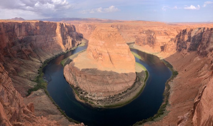
Horseshoe Bend
This is a very popular place, with a huge parking lot, an entrance fee and a half mile walk just to see a view that has been photographed a zillion times. But, of course, I had to do it. What do you think?
Horseshoe Bend. A famous spot in the Colorado River not far from the Grand Canyon.