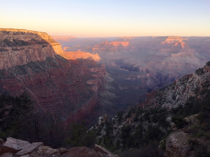
Visiting the south rim of the Grand Canyon must be on your bucket list. Pictures of it are a dime a dozen, but they are no substitute for being there. Being there is an experience. Par excellence. There is no substitute. Everyone who attempts to describe it must inevitably fail, so I won’t even begin to do so. Just go there.
My primary reason for visiting the Grand Canyon was to hike rim-to-rim. I would start at the south rim, hike down to the Colorado River and ascend to the north rim. After an easy day atop the north rim I would return to the sound rim via a slightly different route on the third day.
My secondary reason for visiting the Grand Canyon was to explore some of the secondary hiking trails with a view to going back some day to places that ordinary tourists do not even suspect exist. As will be explained later, I abandoned this goal and ended up with very tame but still enjoyable walks along the south rim.
The first thing you should know about hiking into the canyon is that there are numerous signs on the south rim warning against doing just that. They use very severe language. Here are just a few:
Which question gives a wrong answer?
Far be it from me to foolishly cast them aside. But I wasn’t going to hike back to the originating rim in one day. No, not me. After hiking from the rim to the river, I would hike across the canyon and then up to the opposite rim. (Then two days later, I would reverse direction and hike back to the originating rim.) See; I’m safe. P.S. If you suspect I’m acting like an idiot, you must read my warning.
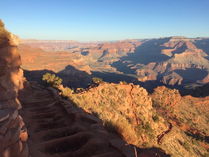
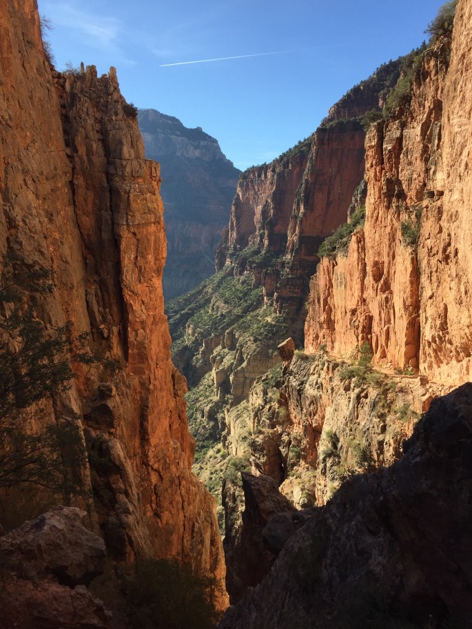
So I headed down the South Kaibab Trail, thusly …
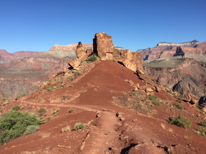
Near the trailhead shortly after dawn. The journey is underway.Still in the light of the early morning sun, O’Neill Butte steals the show at the Ooh Aah Point.The Kaibab Trail quality varies considerably. Here, I’d rather be watching the scenery, but the trail demands watching.Surely you jest! The trail descends steeply along switchbacks and the the green bench below it.The emergency phone here uses telephone poles and wire. How quaint. How unexpected in what you might think is pristine country. In fact, while amazingly pristine, there are outposts of civilization here and there.
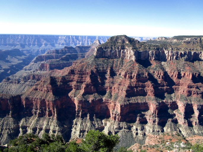
The middle elevation shown here is not steeply sloped, giving the vegetation a chance to get a foothold, so it appears almost solid green. The sides show off the red and white rock layers.
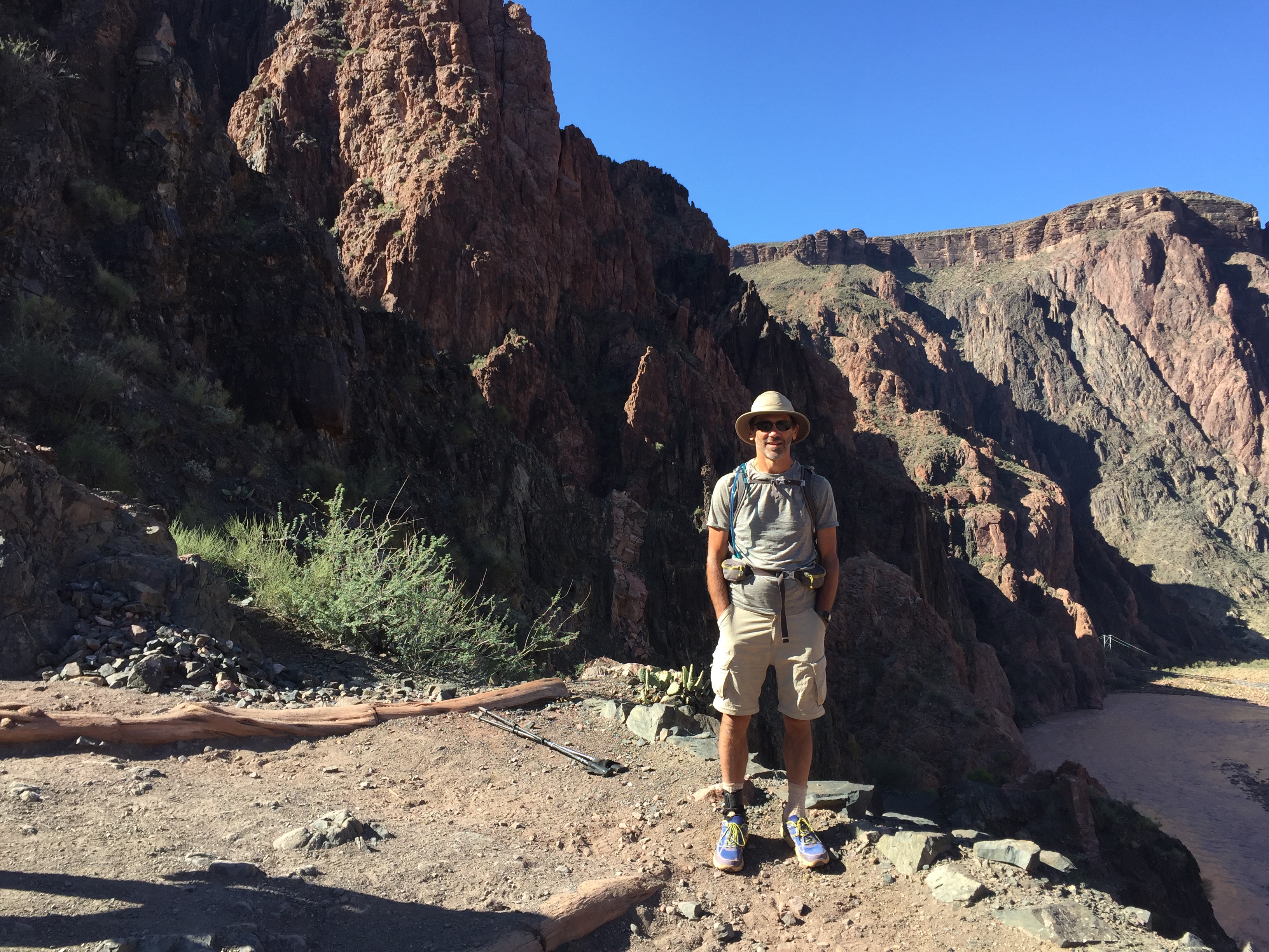
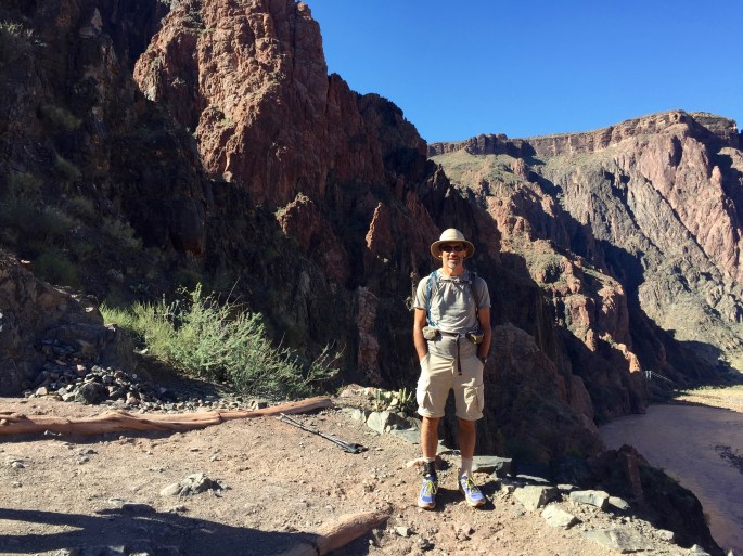
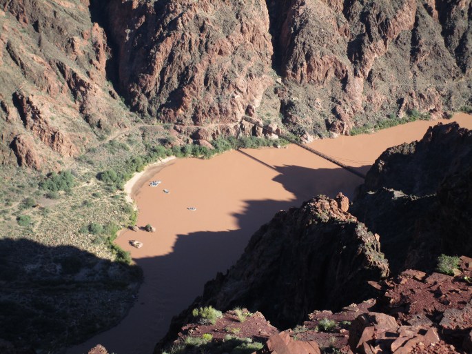
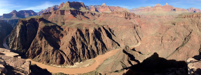
An unidentified hiker poses for the camera this superb overlook. He seems to be enjoying a nice walk in the Park.While this panoramic picture inevitably distorts the view, it still shows off the Colorado River gorge nicely.River below, mesa up top, erosion in between. It’s all so amazing.From this vantage point, you can watch the rafts on the river.
The next threes pictures are somewhat out of place. They were taken on the return journey, when I took a side trip from Bright Angel Trail (only a couple miles from here to the NE) to Plateau Point. Although the latter trail is plain as day, I bet the large majority of hikers don’t go there. Too bad for them. The view at the end might have been my most exhilarating view at the Grand Canyon. It certainly was the most surprising.
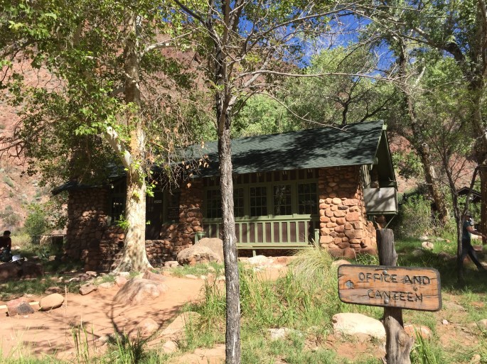
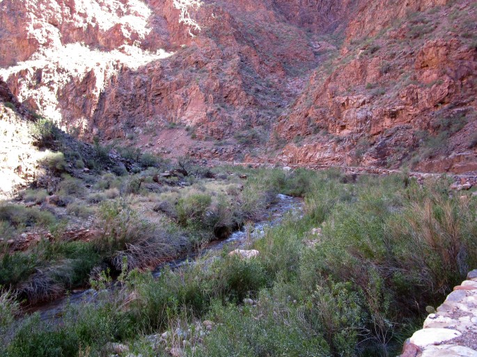
Along the Plateau Point Trail, the view stretches around, across, above and below the hiker. Everything seems distant.Amazing color. Many different rock arrangements. And a brown river that blends right in.The view at Panorama Point is so wide that you can’t take it all in with one shot. It is so tall that you can’t get it all vertically either. This photo was the best compromise I could make.Bright Angel Creek has amazingly clear water. The Black Bridge is in the distance.Did you know there’s a ranch at the bottom of the Grand Canyon? Phantom Ranch is for people (and mules), not cattle.Early in the journey up Bright Angel Canyon along Bright Angel Creek
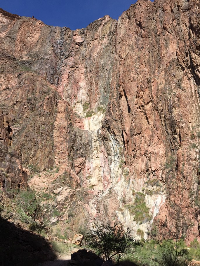
The rock seems to be flowing downhill.A pair of cute waterfalls long Bright Angel’s Creek’s journey to the Colorado River.All of the drinking water for both rims comes from Roaring Springs, which is several miles up the trail. The pipeline is ancient and breaks every now and then. This break didn’t seem to affect water delivery to any significant extent.
This amazing natural rock formation offers rest to the weary traveller.See the two people ahead? They’re trail runners. They’re running from rim to rim – and then back! That’s at least 42 miles and 10,000 feet of elevation gain.Bacon Rocks. I’ve only seen them here in this one, small place and at Targhee Pass in Idaho.
Roaring Spring (which is taller than you see here) supplies all of the drinking water to both rims.
Hiking up to the north rim in late afternoon, the colors were an amazing blend of orange and pink. Too bad this picture can’t do them justice.Heading up to Coconino Overlook, the trees belie the desert nature of this area.Can you spot the trail? How about the power or phone lines?At the Coconino Overlook. 80 miles away is Humphreys Peak, the highest mountain in Arizona.I made it to the North Rim! Now it’s just a simple matter of walking about two miles to Grand Canyon Lodge and my room. Piece of cake! But it will end after dark and get kinda cold.
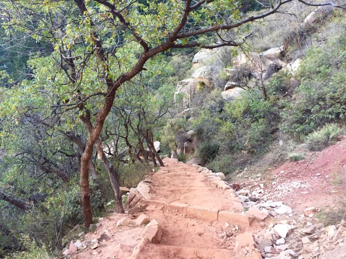
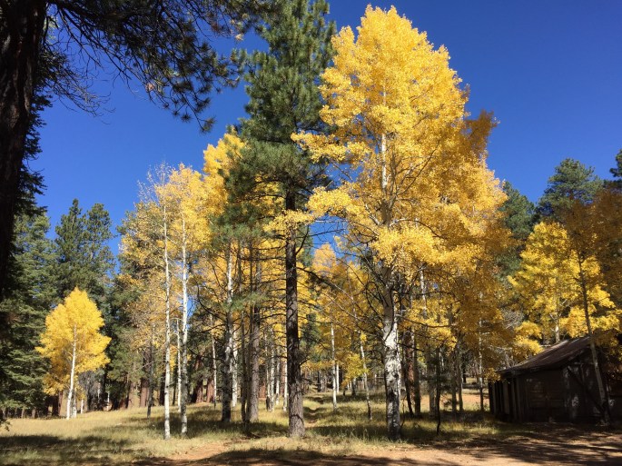
After spending a day wandering around the north rim, I hiked back to the south rim. Then, to my surprise, my adventure seemed complete. Although I had planned to hike some of the major secondary trails, something inside of me felt that I was done. In a few days I would be driving home. For perhaps the first time in this adventure, I decided to take it easy. I was actually ready to go home then, but I lingered. I primarily walked the Rim Trail from end to end (an easy and rewarding journey if you ever go there) with a few other short trips thrown in for variety and shopping. Below are some pictures that do not fit into the grand narrative of a rim-to-rim journey. I think they’re worth showing, but they are rather disorganized.
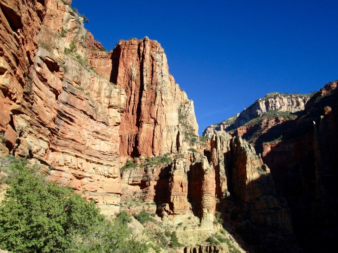
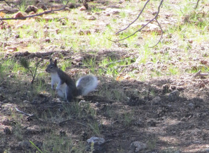
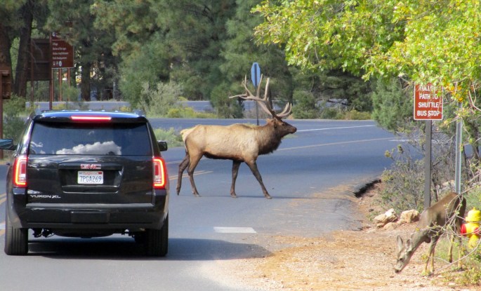
Looking across The Transept and toward the distant south rim.Looking up The Transept.The north rim has some nice views that are reminiscent of those that are common on the south rim. This is one of them. The San Francisco Peaks are 80 miles away to the south. They include Humpreys Peak, the tallest mountain in Arizona.An ordinary pine forest (northern Arizona style) was a nice, quiet alternative to the boisterous red rock country of the canyon.There was a little bit of color at the north rim (but not the south rim). It was pretty when it was there.The Kaibab squirrel is actually famous. The Grand Canyon area is the only place where it is found. This one was very camera-shy. I also took many lousy pictures of it.This elk was only about 6 feet away from me as I walked through Mather Campground. I didn’t even notice it until I was next to it.Seeing wild animals in their natural surrounds can be quite a thrill, but I found no thrill in seeing this elk wandering around Mather Campground and slowing traffic. It’s almost sad.Red, white and everything in between. An easy view along the western portion of the Rim Trail.A personal favorite, but I can’t explain why.This picture gives you a good view of the trip across the canyon via the Bright Angel Trail. Athough I actually hiked it from the top of this picture to the bottom, I’ll describe it as if I went in the opposite direction. It starts as a long descent beyond the lower right corner of this picture and follows the wandering trail you see below. (The other “trail” is actually a wash.) It goes through the intense green area in the middle, called Indian Garden, which is a pleasant respite. While you think you can see the trail continuing ahead to a dropoff, that’s actually the Plateau Point Trail, a wonderful side trip. The Bright Angel Trail actually descends through the crack you see after the far end of Indian Garden. It heads down along along the hidden Piple Creek and eventually to the river, through very interesting dark gray granite, and then crosses the river via the Silver Bridge. On the other side, the North Kaibab Trail passes by Bright Angel campground and Phantom Ranch and then ascends along Bright Angel Creek through the big gorge that heads toward the top of the picture. It takes an unseen bend to the left, leaving Bright Angel Creek to climb up to the north rim, which is just above the white layer. Highly recommended for those who have thoroughly plannned for it.