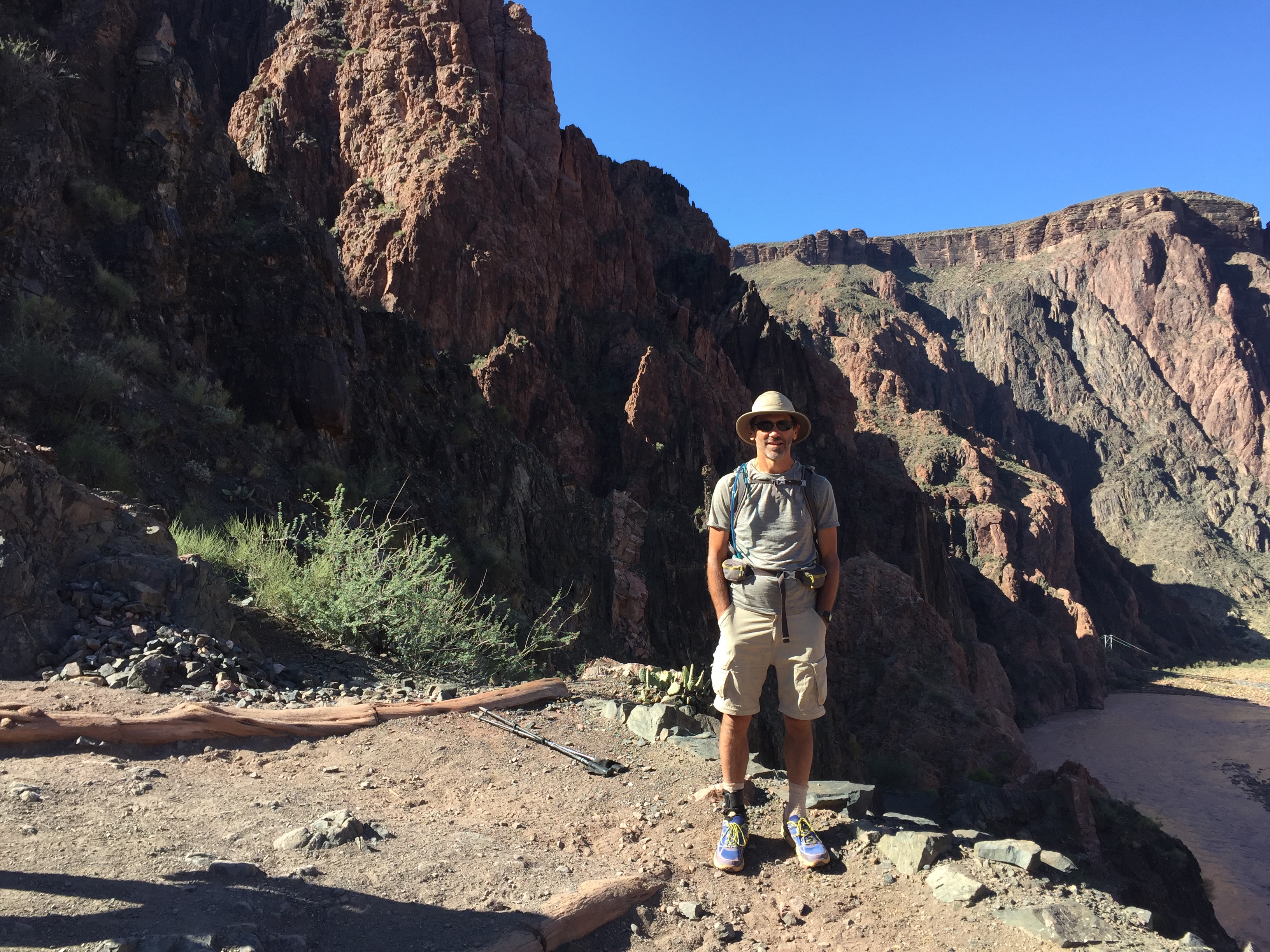
Death Valley may be a terrible place to be in the summer as the NPS brags about, but spring is a different story entirely. In this, my first trip there, I visited the middle section. In the following year, I would visit the east section.
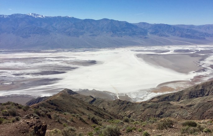
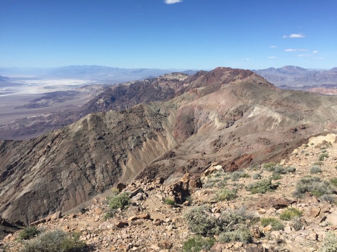
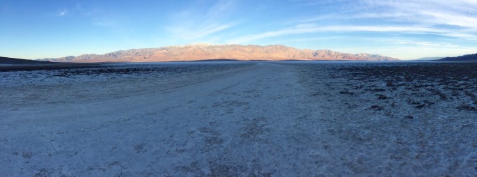
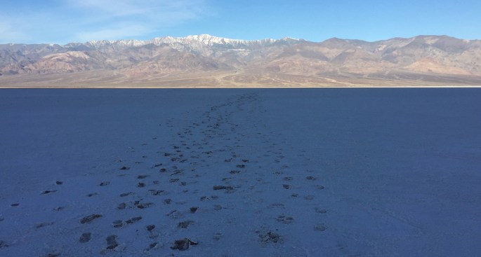
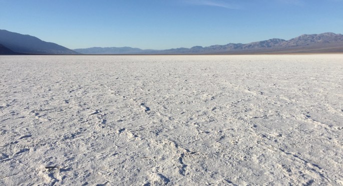
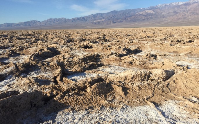
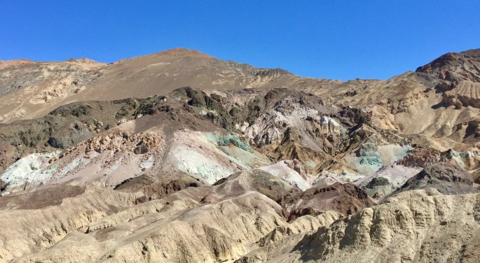
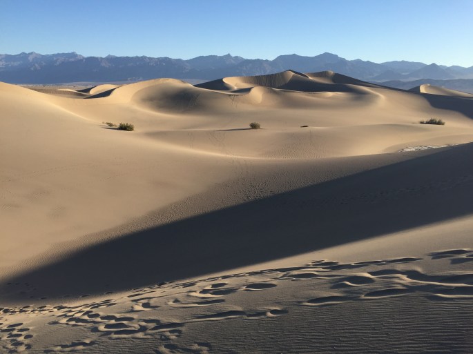
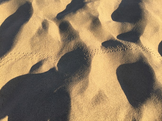
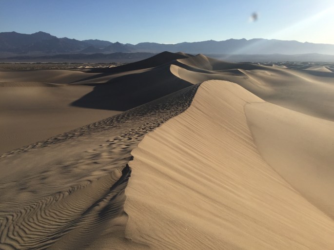
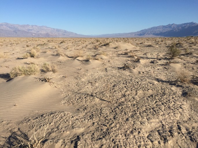
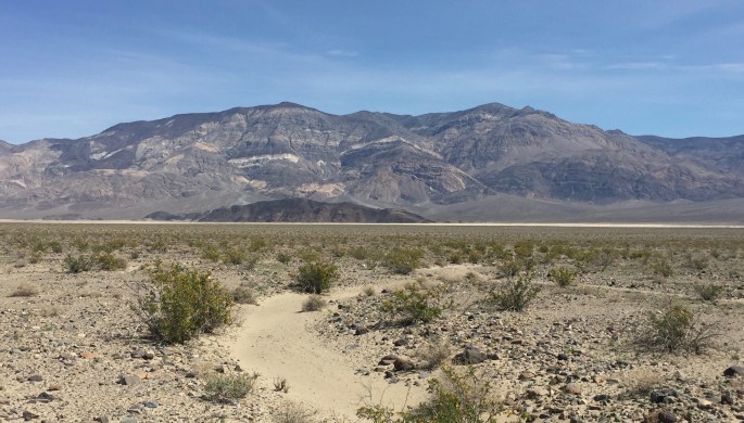
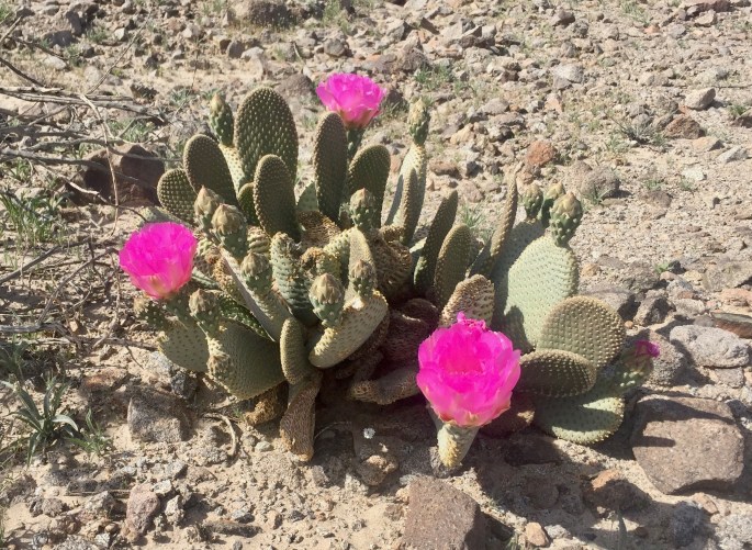
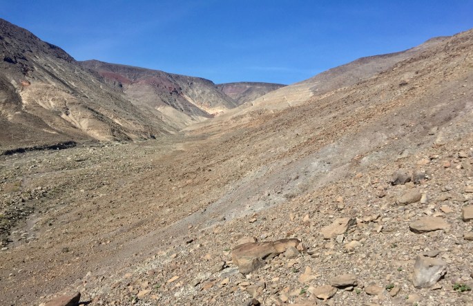
This is Badwater Basin, the most famous section of Death Valley. It contains the lowest point in the Northern Hemisphere. It is also one of the hottest and driest places in the world (depending upon how you measure). Many people come here see it. Some walk on it; you can even see their trail at the bottom. But only a few venture out very far. Of course, that group would include me. Tomorrow I would go a little more than halfway across. Someday I hope to cross it and continue to Telescope Peak, upper left, the highest point in the park.Can you count the colors in this picture?Many parks boast of having mountains and maybe even a mountain range, but Death Valley has several mountain ranges, each of which has its own defining characteristics. Variety is the spice of life, IMHO.Rugged features and delicate pastel colors define this area of Death Valley.The early morning sun lights up the Panamint Range while I prepare to head on my trip to discover what it is like on Badwater Basin. I had read a number of reports, but I couldn’t relate to them very well. I needed to experience it myself, especially after an unusually snowy winter. I wouldn’t cross it today, but I’d learn something for a future visit.It’s obvious that here people walk down the middle but few walk very far to the sides.There isn’t much walking out here. The little nodules are about an inch high.There is actually water underneath the salt! Not very much but enough to form a layer of mud. Human feet break through the salt and into the mud.To the side, the salt stretches for miles.Vague hexagonal shapes define this area of the basin. Why?The terrain becomes rough as salt and dried mud mix. The dried mud ridges are several inches high.No mud here. Lots of mud over there.The mud lingering beneath the salt surface becomes deeper, telling me it’s time to turn around. A few others have gone on. I hope to do so in a drier year.Artists Palette is an impressive assortment of pastel colors concentrated in one small location. I don’t know how well your monitor picks up the colors, but it real life, I found it impressive.It can be a weird experience to walk up a canyon, such as Fall Canyon, that is so obviously formed by water when it is as dry as a bone.If you prefer to drive through canyons (and have an appropiate vehicle) pick Titus Canyon Narrows.The Mesquite Flat Sand Dunes in the morning sunlightSome little critter left its tracks here.Another view of rhe Mesquite Flat Sand Dunes in the morning sunlightBeyond the edge of the Mesquite Flat Sand Dunes, where no one else goes, the various kinds of dried mud told a story that I enjoyed analyzing. Sorry, I know I’m odd.Sand dunes transition to the flats of this northern section of Death Valley.New kinds of dried mud. Cool.These green bushes obviously get quite a bit of water in this desert, but up there? They’ve clearly survied for years, but how?The dried mud is rough here. It must indicate faster moving water, right?Water flows through here and leaves occasional islands of stability that can support bushes.The smooth dried mud in the foreground implies slow-moving water, while the rough mud above it indicates faster-moving water. Beyond that, clumps (but only clumps) of vegetation hang on to life. In distance, an alluvial fan reveals greater water flows. All of this while no water is in sight! What do you think? Am I as good at deduction as Sherlock Holmes?Shown here is a rather remarkable contrast. The upper left shows Badwater Basin, the hottest place in the world (by some measure) and the lowest place in the northern hemisphere at -282 ft. A mere 15 miles away (more or less) in the upper right is Telesccope Peak at 11,043 ft. The trail on the far right takes you there. I had hoped to hike to Telescope Peak on this trip, but the snow and mud rendered the attempt impractial for me. This was my compromise. Manyana.Father Crowley Point adds yet another look to this very diverse parkThis is not everyone’s idea of fun. I set out across the northern part of Panamint Valley where few people ever go. Something about wide open spaces appeals to me. The small sandy area near the middle is the Panamint Dunes. They’re not very impressive, but they were rather far away. It took me four hours of walking across the desert to get there. The answer to the question some of you might raise was given almost a century ago by George Mallory.I liked the layers on the mountains in the background. The darker mini-mountain contrasts with it. A vast sandy plain stretches from side to side but here seems to be just a thin line.The Panamint Mountains rise above Panamint Valley as they do above Death Valley. Snow contrasting with sand.A view from one of the few peaks of the Panamint Dunes. It took nine miles of walking to get here. For a few people (perhaps) it’s worth the trip.Every now and then I’d find a prickly pear in bloomThis remarkable little critter seems be gathering nectar from and pollinating some desert plant. Flying like a hummingbird and about the same size, I believed it to be a moth. I thought it was quite the sight. After I returned, I determined it to be a hummingbird moth, particularly a White-lined Sphinx.Sunset will be here soon. The valley already lies in the shadow of the mountains on the west side of Panamin Valley. I’ll set up camp here before the east side succumbs.Day 2 here was spent exploring the hills. It was not as easy as day 1.Green shrubs, yellow flowers, geological layers at a 30º angle, and a boulder that seems like it belongs somewhere else.