Annapurna Region: Annapurna Circuit from Low to High
The trek started at the rather low elevation of 2490 ft in Besisahar and went as high as 17,769 ft at Thorung La (pass). It was clearly my favorite section. Here are some of the scenic highlights. Notice how it begins with lush, green countryside and an abundance of water and transitions into a barren but spectactular land of sand, rock, snow and ice.
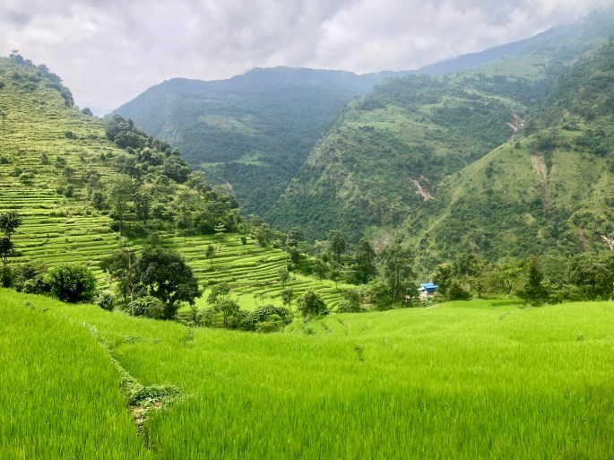
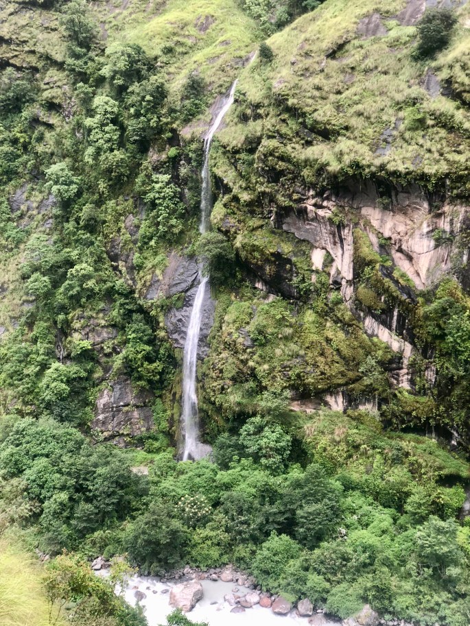
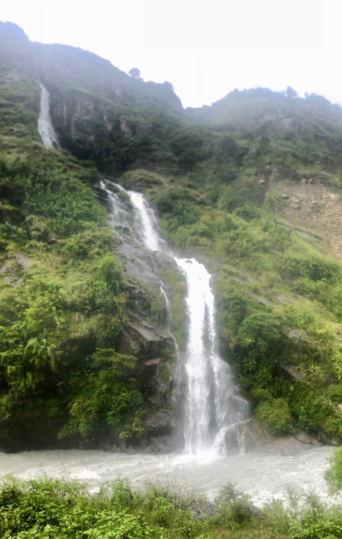
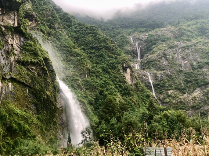
Terraced fields were rare on this trip. But they were picturesque at low elevations.One of numerous waterfalls in the areaWaterfalls were never very far away, but in the first few days, they seemed to be everywhere, The tall mountains and steep slopes seemed ideal for creating them. This one was perhaps my favorite, loudly crashing into the noisy river below.
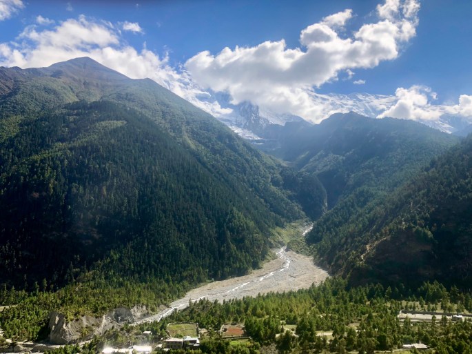
This was about the best picture I got of this monolith. I’ll have to go back to get a better shot.There seems to be no end of waterfalls in the lower reaches of the Marsyangi valleyThe high mountains could be so high that I would forget they’re there
The strange, steep, curved, treeless slope of Paungda Danda (Gateway to Heaven) is unforgettable. Locals believe the spirits of the deceased must ascend this wall after leaving their bodies.
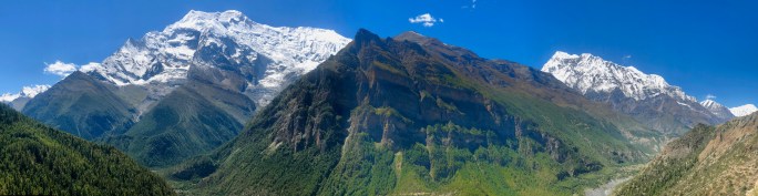
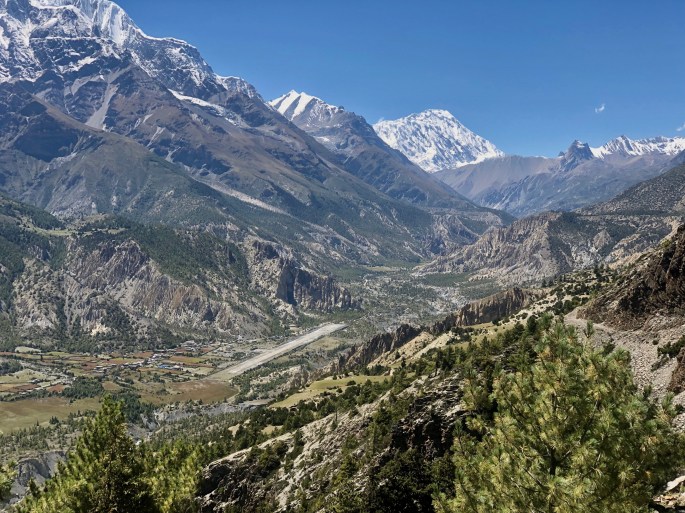
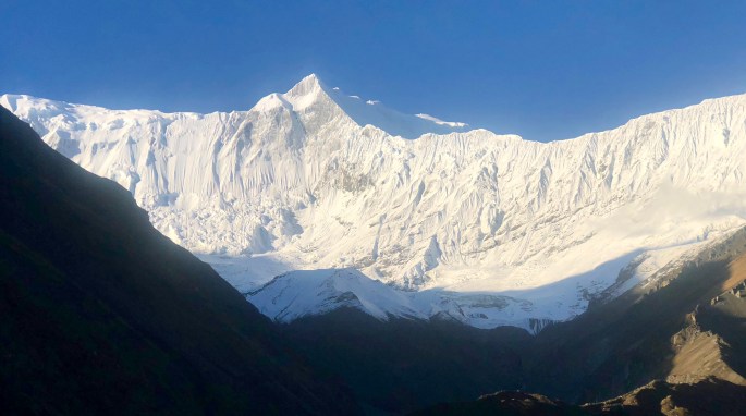
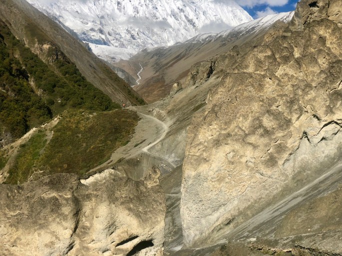
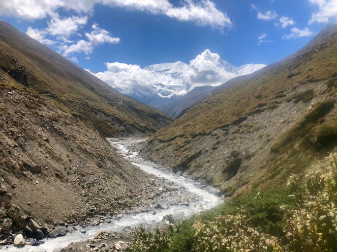
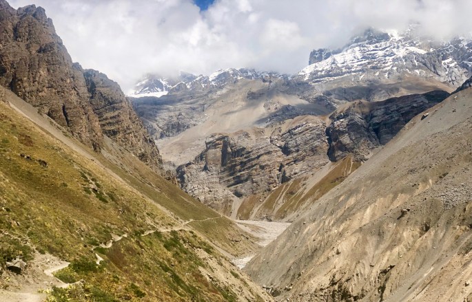
Lower Pisang (center) has an amazing view that includes “low” green mountains, high snowy mountains, the Paungda Danda (background, left of center) and the rushing Marsyangdi River.The village of Humde (lower left) is next to Manang Airport, which is the only one in the region. It’s at a rather high elevation of 11,000 ft, and yet the mountains are twice as high. No wonder the valley is so impressive.I was minding my own business, just walking down the road when I turned a corner and beheld this scene, with Annapurna III being the main focus. It stopped me dead in my tracks.How many ways are there to combine a rushing glacial river with distant, snowy mountains and nearby tree-lined slopes? Beats me, but this seems to increase the total.Blue sky over Gangapurna Glacier. Perhaps my best view of the glacier.The badlands formations near Khangsar are evident on the left side of the riverThe badlands formations near Khangsar are evident on the left side of the riverDo not attempt to adjust the picture. We will control the horizontal. We will control the vertical. You are about to experience the awe and mystery which reaches from the inner mind to (what I termed) “The Land of Ghostly Forms.” Cue strange music.There must be a yeti nearbyAfter climbing for a short while, trees are already a forgotten life form. Enter now the wild land of rock, snow and ice. Here, half hidden by clouds, the massive Annapurna I plays second fiddle to a remarkable foreground.Gray can be a magnificent color at times. And a lack of color can highlight forms and shapes. This is not like the moon, but there is a distant resemblance. Perhaps Buzz Aldrin would say this is “magnificient desolation.”
Tilicho Tal is probably not “the highest lake for its size in the world,” but it’s impressive nonetheless. What better way to show off the blue-green color than with grayscale surroundings? Believe it or not, but a small group of trekkers went swimming in it!
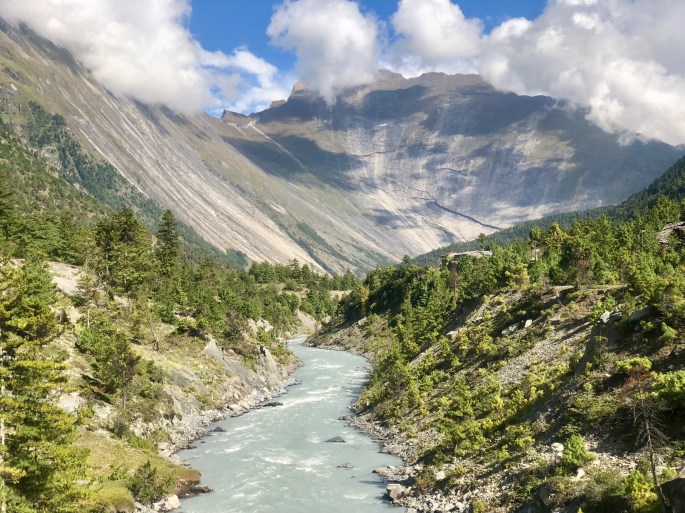
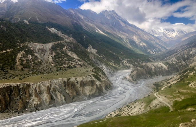
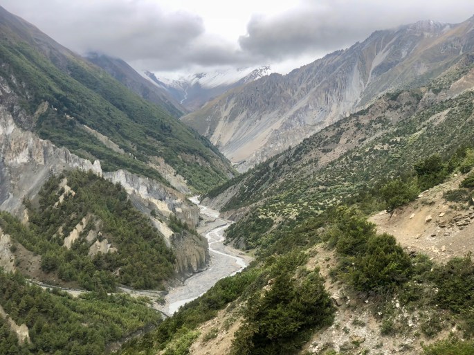
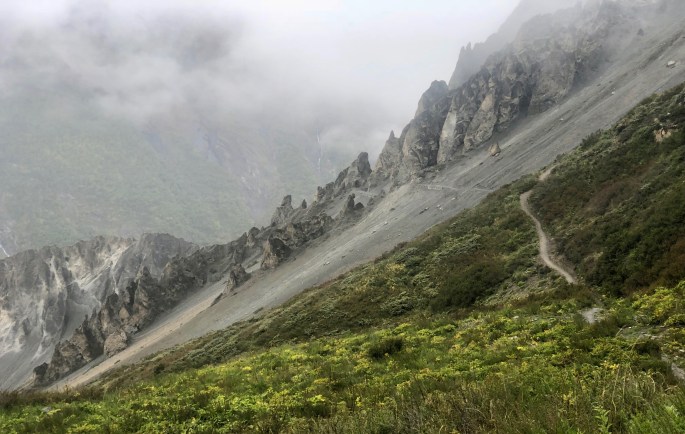
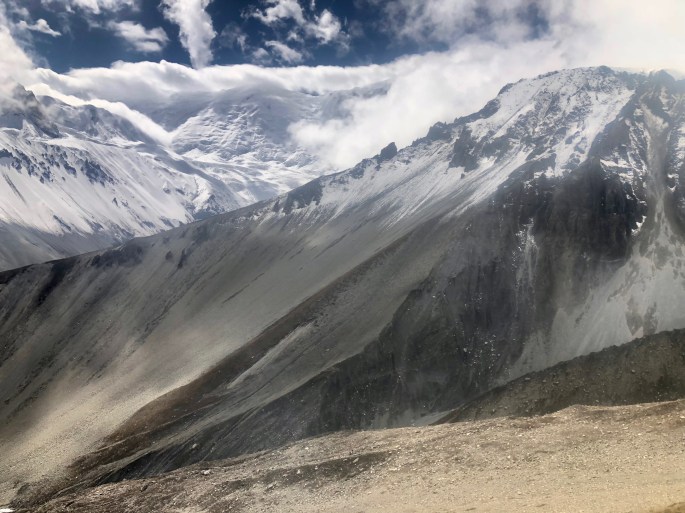
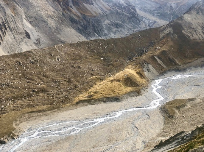
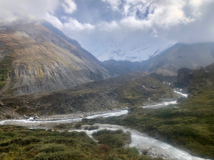
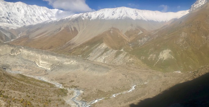
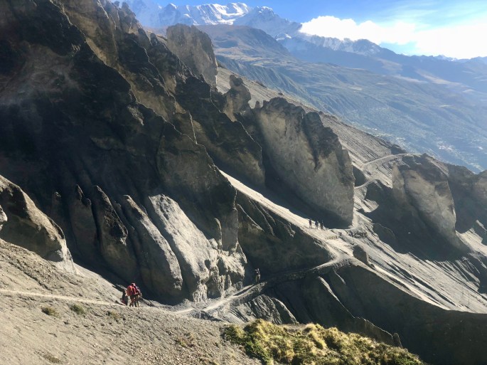
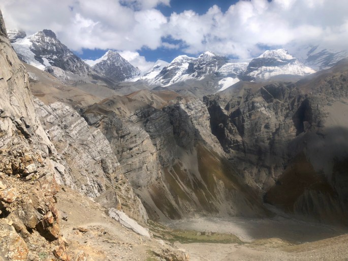
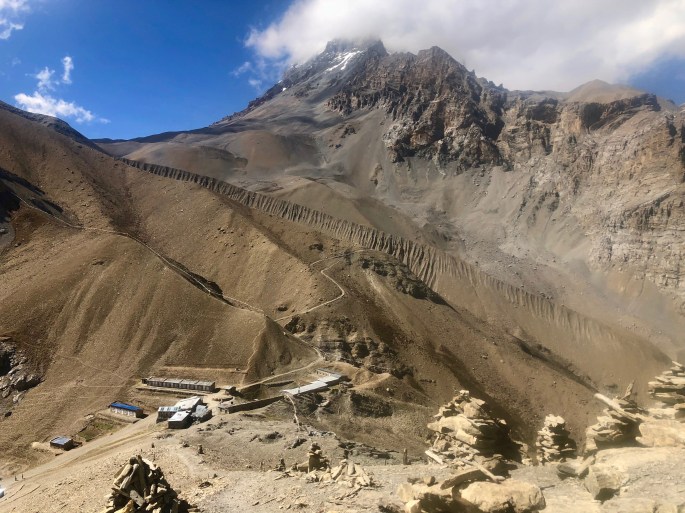
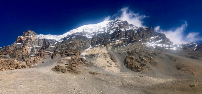
Crystal clear morning view of Annapurna IOn this clear morning I could clearly see what I had only partially observed two days earlier. And now, Tilicho Base Camp and the trail to Tilicho Lake appear.Trekkers enjoy the sublime mountain scenery on a clear mountain morningDid you ever feel this small?In the clear morning light with trekkers passing through, the Land of Ghostly Forms, seems strange but not very ghostly.Manang (center) seems to be almost irrelevant in this view. The badlands formations break up the scene enough to impart and otherworldly aspect to the scene.This is not a common scene in the Annapurna region. The mountains are common enough, but the quiet pastureland is hard to find. In this scene, they make a striking combination.The village of Letdar lies peacefully between the raging Marsyangdi River below and the giant mountains above. If I lived there, I’d spend all my time gawking.Where you have mountains you have riversUnlike the recent snowy mountains, the high mountains here show a mixture of snow and rock. Later on, they will reveal ice in the form of high glaciers. The low mountains seem entirely different, with crumbly rock and slanted at an angle. In Nepal, the scenery is ever-changing.As the trail gets higher some of the high glaciers become visible. From here, it’s thousands of feet down to the river and more thousands of feet to the mountain tops.Thorung High Camp is the highest sleeping location on the trek. It has 3-4 amazingly diverse views depending up which direction you face. This view is a preview of the scenery ahead on the trek over Thorung Pass. FWIW, Note the unusual geological formation that cuts diagonally across the landscape.
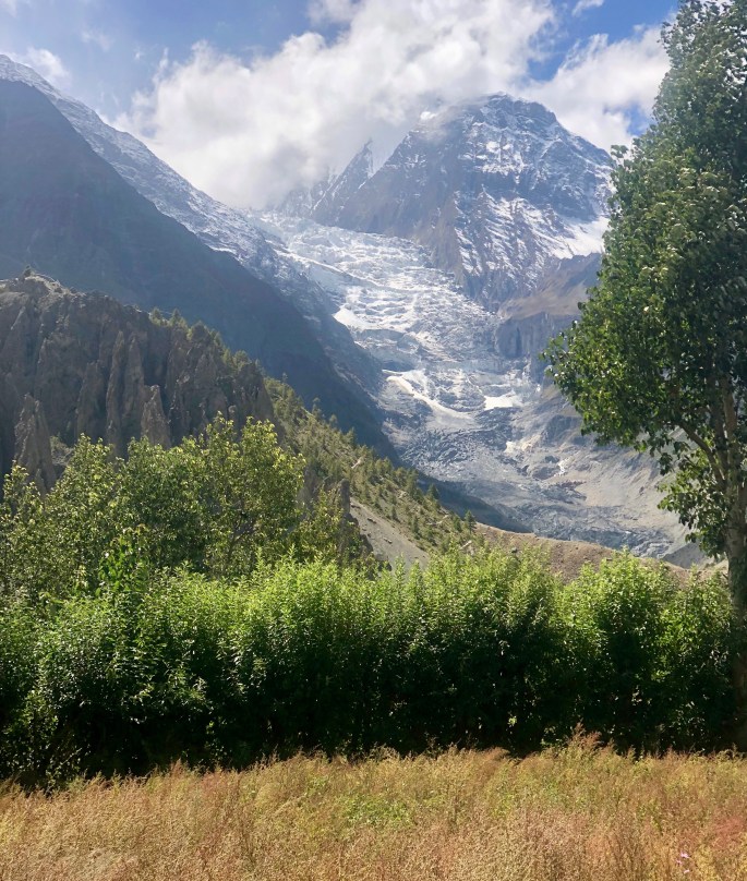
Very long strings of prayer flags, firmly anchored in the mountains, flutter furiously in the powerful winds. Nepal never seems to run out of mountains. Here, the mostly barren mountains contrast with the snow-covered Annapurna giants in the far right.Prayer flags flutter furiously in the stiff wind while glaciers move, well, glacially down between the semi-high mountain peaks. In between is a striking barrenness. It seems that the glacier on the right has been suffering from an acute case of glacial warming.Here come the glaciers. In this scene, they seem to move from a land of eternal snow to a land of never snow.Thorung Pass sits on a saddle between two mountains. This view shows Thorung Ri, to the south.Thorung Pass sits on a saddle between two mountains. This view shows Yakawa Kang, to the north. I thought it was magnificent.