Surely, Zion National Park must have one of the best ratios of great scenery per square mile in the national park system. Over three long dayhikes, I covered a large portion of it.
West Rim Trail
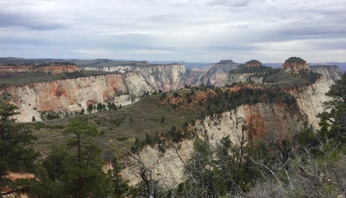
The West Rim Trail seems to be the favorite area for backpackers. Too bad it was cloudy on the day I hiked it. (I also hiked a few nearby trails, but the scenery there was not particularly interesting.) Does it deserve its reputation? Perhaps, but I may have another favorite.
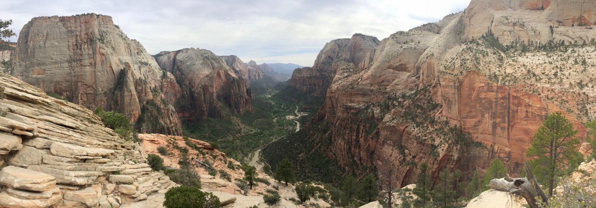
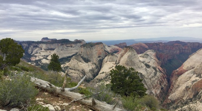
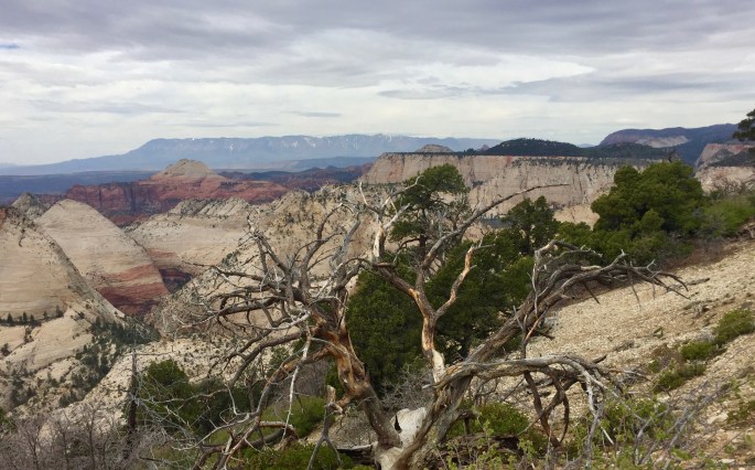
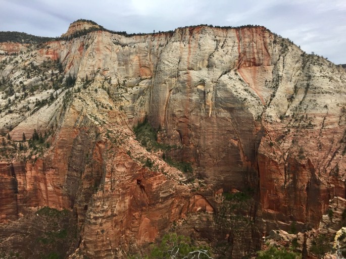
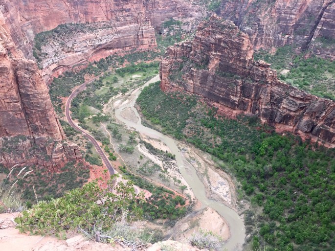
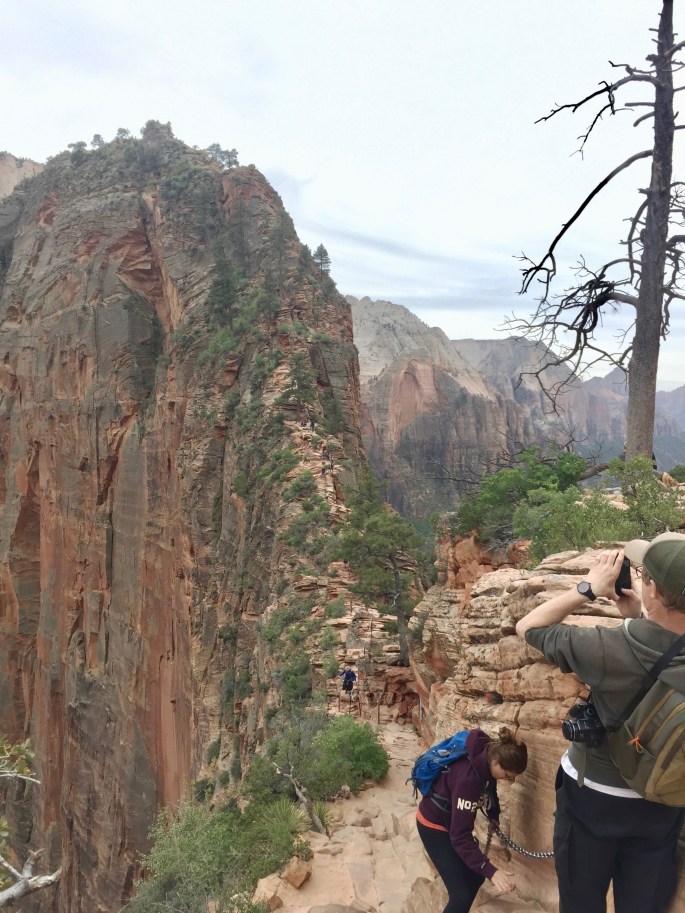
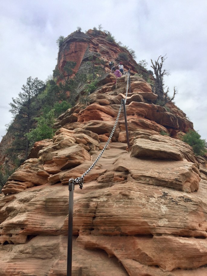
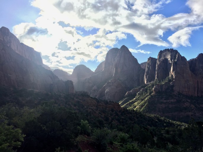
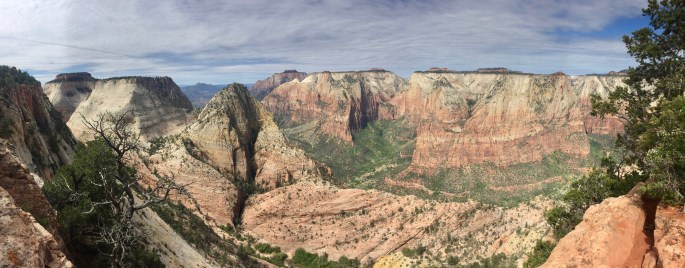
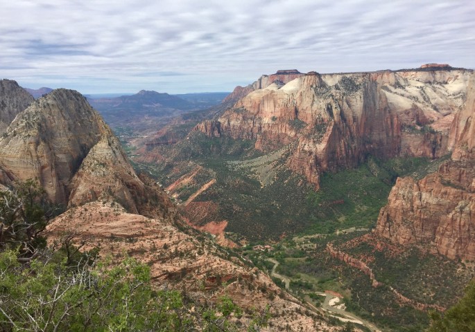
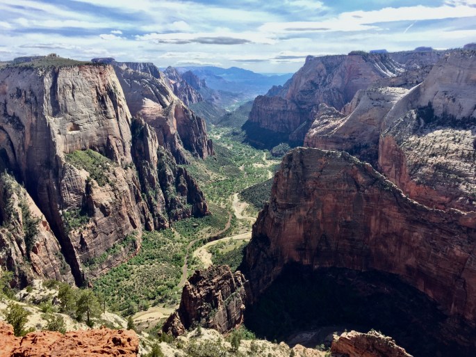
The parallel “battleships” with their parallel canyons struck me as being interesting. On the right is a glimpse into the larger canyon beyond.The mountains in the background have their own look and geology.The high plateaus seem like they would be golf courses if they were located near civilization.The long descent to the valley begins. Hint: You can’t see the valley from this view.A thick white layer sits on top of a thick orange layer below. But the orange color also seems to drip from high above. Surely iron is present, but the two-dimensional aspect seems strange to me.Angels Landing, left of center, is usually considered to be a viewpoint. Here, from the back side, it is something to be observed. Can you imagine the view from its top?Who ever bothers to read warning signs?Does this view of Angels Landing stoke your sense of adventure? It should. There are some tiny colored little dots along the ridge. They are people headed for the summit. Wanna go along for the ride?First, you need to know that this is the view down.Now do you see the dots, i.e. people?Oh. There’s a chain. That makes it easy. And safe. Nothing to worry about.Here is the visual reward for your climb: The classic view down the best part of Zion Canyon. (Too bad it’s a cloudy day.) That’s the Virgin River below. One of the (perhaps) surprising things about Zion is that, for a desert area, it has a lot of vegetation in places. Where there’s water, there’s vegetation.Here’s a wider view of Zion CanyonThe view in the opposite direction is also impressive. Notice that the canyon narrows until it seems to disappear. That’s where The Narrows hike (one of Zion’s standout features I left for a future visit) begins.Here’s the view going down. Ready? Just hold on to the chain whenever it’s present.The trail continues down until it levels off. Then it heads down to the valley by taking a route to the left. But, perhaps unnoticed by most, it goes back up (including the trail segment you can see here) until it goes all the way to the top. In fact, that’s the way I arrived here.
Kolob Canyons Area
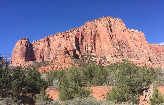
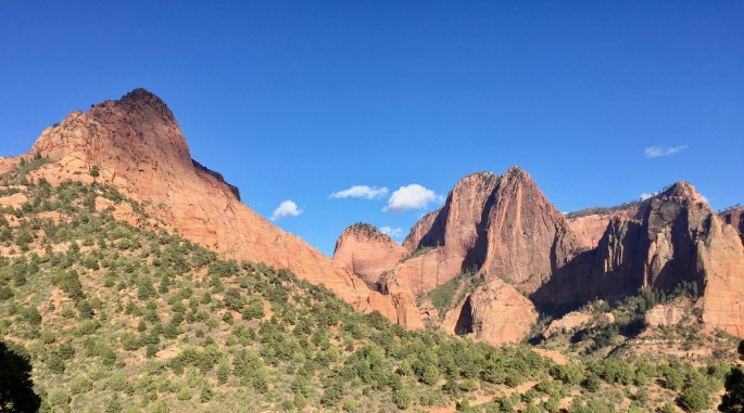
The Kolob Canyons are in the northwest corner of the park. The canyons and the accompanying “mountains” are very interesting in their own right, but I only saw them via car. For my hike, I stayed down low by the creeks and looked up.
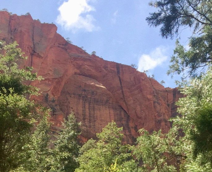
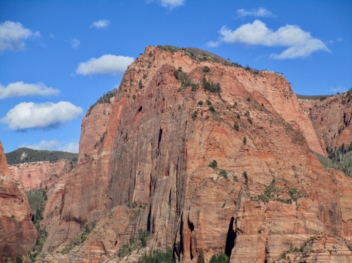
I started the hike by heading down, but I was still able to get this high view before I got very far.Although the morning sun was extremely harsh, both on the road and on the trail, I could tell this was an impressive area. This was about the first place I could really observe it.Where there is water, there is life. It’s such a simple rule even in a desert.The Hop Valley Trail follows a slow, winding La Verkin Creek through a wide valley and crosses the creek every now and then.Impressed? This is the Kolob Arch. At 287 feet long, it is the sixth longest natural arch in the world. I was never impresed by pictures of it. In person, it’s not any better. because of the odd angle and the distance. At least I was there to see it in person.Desert flowers always cheer up any scene.I’m a big red rock fan.One thing that struck me about Zion was how vertical many of the rock faces could be.This is a good view of the Kolob Canyons area from below.
Today’s hike is sponsored by the Kolob Canyons. Ironically, this area is named after, not the impressive mountains and buttes you see here, but the associated canyons. Beats me.
East Rim Trail
Just as the West Rim Trail runs (in part) along the west rim of Zion Canyon, so the East Rim Trail runs (in part) on the east rim of the same canyon. Which is better? Beats me. You be the judge. (Of course, I hiked some other trails as well.)
Waterfalls are always fun. This one was at the head of Jolley Gulch. I wish I had had a viewpoint that showed the whole fall as well as much of the gulch.
Another waterfall? I though I was in a desert. It sure doesn’t look like one around here.
In some parts of Zion, it doesn’t look like a desert at all.
This view was several miles from the main trail. Do you think it was worth it?
Huh?
Is there no end to the scenic wonders here?Observation Point gives a longer view of Zion Canyon than the one seen from Angels Landing (center right). But is it better?Toward the end of the East Rim Trail, I was pleasantly surprise by a walk through a rather deep slot canyon.Weeping rock is a strange combination of rock, vegetation, colors and water at various angles. It’s very cool, even if it is “impossible” to photograph in its entirety. It’s a short walk from a shuttle stop.