This trip was an immersive, weeklong journey into the place Teddy Roosevelt called, “The one great sight which every American should see.” Instead of looking on it from above, as most visitors do, I descended to a midlevel view where I could look up as well as down. My route ran from Hermits Rapids on the West to Clear Creek on the East and finished on the Bright Angel Trail in the center. It was based on the Tonto Trail, a trail which stays on the top of a geological layer known as the Tonto Platform. In theory, the trail stays flat, but in reality, it mostly goes up and down at a moderate rate. I made it down to the Colorado River a few times but did not return until the end. I even spent some time (as little as possible) in the popular Corridor Zone. It was an amazing experience, most of which cannot be conveyed with photos, but I’ll do my best.
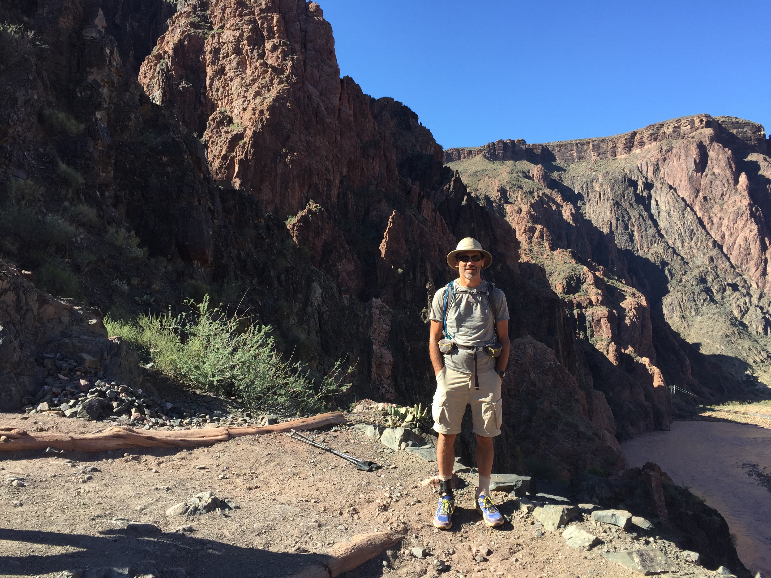
My entrance to the backcountry was the Hermit Trail, which follows Hermit Creek, which lies at the bottom of this little canyon (of course). Some “creek.” The background shows me what awaits.
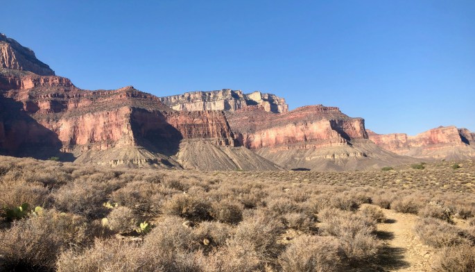
This view looks back up toward where I started. From now until the last day, most of my time would be spent at this level where I could look up to the rims and/or down toward the river.
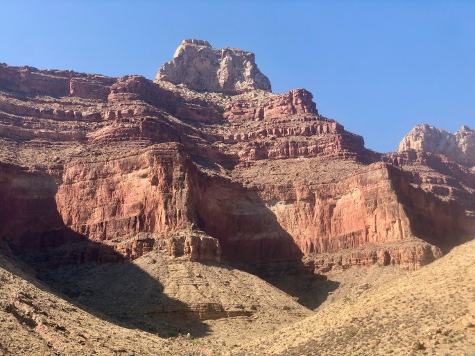
Hermit Creek has carved a very narrow canyon in places
The Colorado River at Hermit Rapids (right)
The turbulent waters of Hermits Rapids
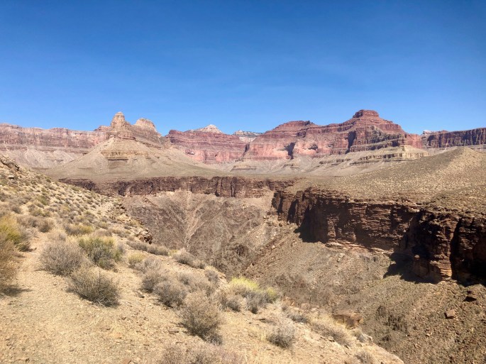
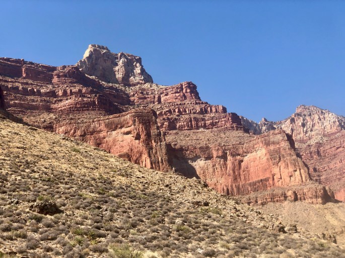
Life on the Tonto Platform. The Tonto Trail (left) tries to stay on flat terrain, but it also encounters large drainages (lower and right). Instead of descending and ascending on the other side (a very challenging proposition), it goes around the drainages. Thus, travelling a large distance on the trail results in a more moderate distance in a forward direction. Drainages can merge, but all of them ultimately end up on the Colorado River. Once in a while, a drainage contains water, in which case we have what is here called a “creek.”
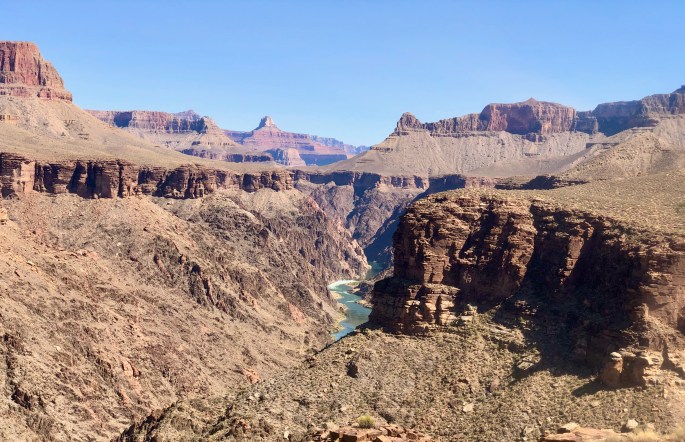
This part of the Colorado River is called Granite Canyon. The steep black-brown walls hide the river unless you can see it from just the right perspective.
It is an odd fact that the canyon immediately adjacent to the Colorado River, that views of the river itself are not common. This view shows an unusually long stretch of the river. Another surprising fact about the Grand Canyon is that some views are almost entirely green.
Life on the Tonto Platform. The Tonto Trail (left) tries to stay on flat terrain, but it also encounters large drainages (lower right). Instead of descending and ascending on the other side (a very challenging proposition), it goes around the drainages. Thus, travelling a large distance on the trail results in a more moderate distance in a forward direction. Drainages can merge, but all of them ultimately end up on the Colorado River. Once in a while, a drainage contains water, in which case we have what is here called a “creek.”
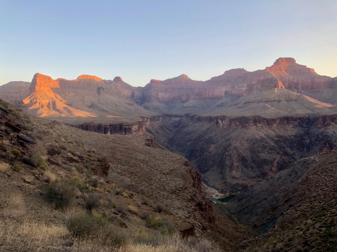
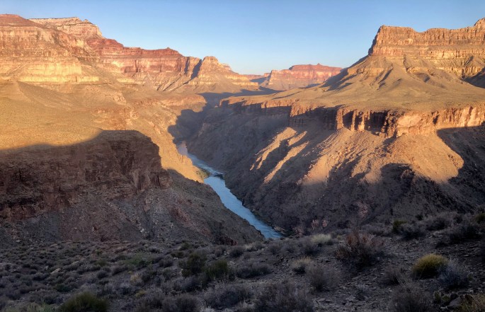
Soft early morning and a quiet river light bring a feeling of serenity
I enjoyed this particular viewpoint expecially since I had to leave the trail to visit it. This made it more personal to me.
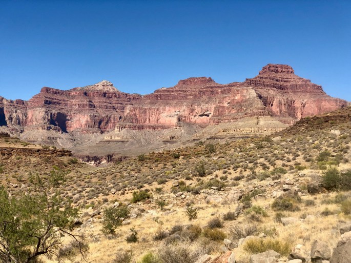
A rather colorful scene
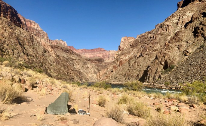
The Colorado River here flows placidly but swiftly
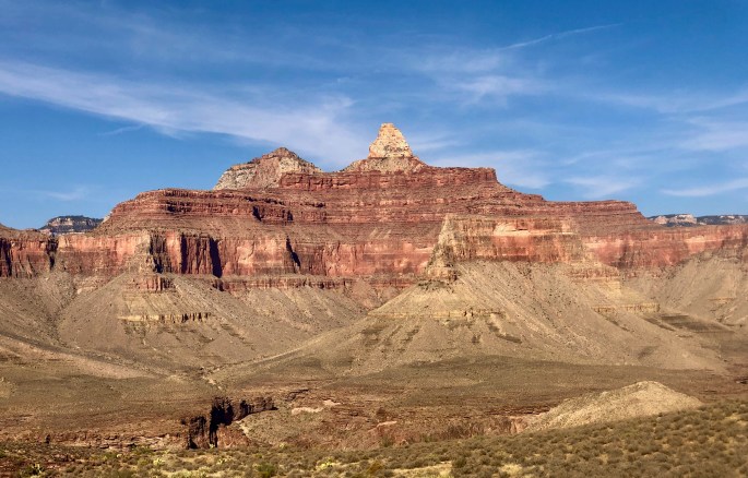
Peakfinder says this is Zoroaster Temple, but I see a throne. It’s not Wotan’s Throne, so what is it called? I suspect this is just a different perspective on Zoroaster’s Temple, where the white part appears as a wall instead of a triangle and the throne emerges from the new viewing angle.
Peakfinder says this is Zoroaster Temple, but I see a throne. It’s not Wotan’s Throne, so what is it called? I suspect this is just a different perspective on Zoroaster’s Temple, where the white part appears as a wall instead of a triangle and the throne emerges from the new viewing angle.
The North Rim makes a large 90º bend here as that’s clearly evident on a map. The bend is compelled by the massive Howlands Butte in the rear. One result is the large drainage made by Clear Creek below.
You won’t see this view of the North Rim in any standard source
With the North Room looming above, my destination lies among the trees below – if I can navigate the somewhat scary descent trhough the brown stuff
Sometimes it feels like you own it all
An advantage of hiking into the canyon is that you can see things near (right) as well as far away (back).
This picture shows why a view from within the canyon is necessary. The Zoroaster Temple here is frequently seen from a distance in rim photos as a strange triangle shape. Here, from below and nearby, it is shown as much more. Do I consider this photo to be superior to the rim photo? Not at all. The two are complementary, with one showing it as it is and the other showing its place among the other rock marvels of its neighborhood.
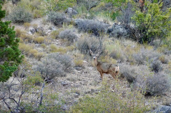
I find it hard to imagine how a large herbivore such as this deer can find enough food in this dry place.
The hordes at the South Rim Visitor Center are milling above and behind the upper left of this picture. This is the view that they can’t see, and only a relative few witness it.
Bright green is an unmistakeable marker of substantial water in the desert, and big trees are the best indicators. But, the water is not necessarily present right now. In this case, the water is perennial.
Indian Garden is a lovely oasis. Unfortunately, it’s not a secret.
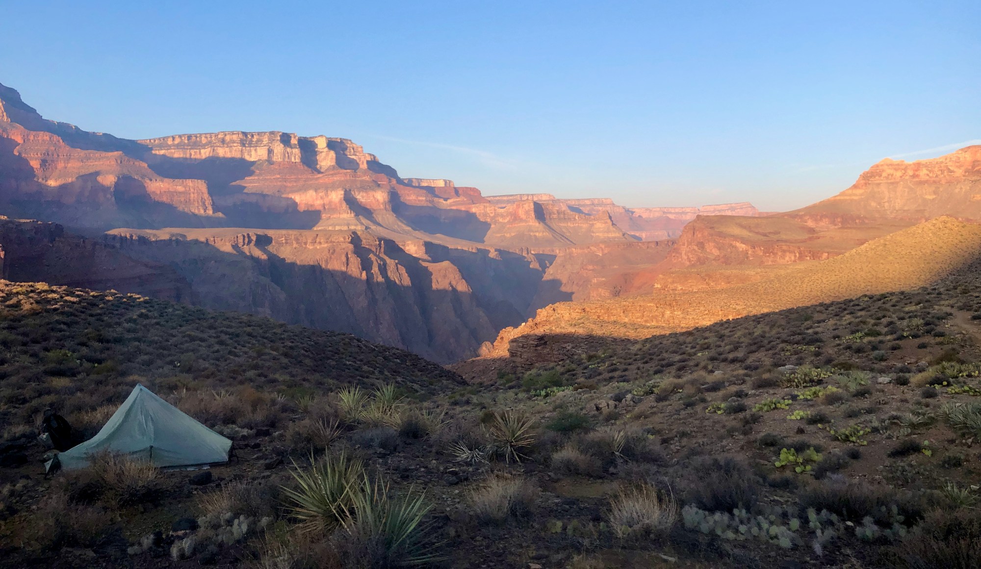

 This view looks back up toward where I started. From now until the last day, most of my time would be spent at this level where I could look up to the rims and/or down toward the river.
 Hermit Creek has carved a very narrow canyon in places
 The Colorado River at Hermit Rapids (right)
 The turbulent waters of Hermits Rapids
 Life on the Tonto Platform. The Tonto Trail (left) tries to stay on flat terrain, but it also encounters large drainages (lower and right). Instead of descending and ascending on the other side (a very challenging proposition), it goes around the drainages. Thus, travelling a large distance on the trail results in a more moderate distance in a forward direction. Drainages can merge, but all of them ultimately end up on the Colorado River. Once in a while, a drainage contains water, in which case we have what is here called a “creek.”
 This part of the Colorado River is called Granite Canyon. The steep black-brown walls hide the river unless you can see it from just the right perspective.
 It is an odd fact that the canyon immediately adjacent to the Colorado River, that views of the river itself are not common. This view shows an unusually long stretch of the river. Another surprising fact about the Grand Canyon is that some views are almost entirely green.
 Life on the Tonto Platform. The Tonto Trail (left) tries to stay on flat terrain, but it also encounters large drainages (lower right). Instead of descending and ascending on the other side (a very challenging proposition), it goes around the drainages. Thus, travelling a large distance on the trail results in a more moderate distance in a forward direction. Drainages can merge, but all of them ultimately end up on the Colorado River. Once in a while, a drainage contains water, in which case we have what is here called a “creek.”
 Soft early morning and a quiet river light bring a feeling of serenity
 I enjoyed this particular viewpoint expecially since I had to leave the trail to visit it. This made it more personal to me.
 A rather colorful scene
 The Colorado River here flows placidly but swiftly
 Peakfinder says this is Zoroaster Temple, but I see a throne. It’s not Wotan’s Throne, so what is it called? I suspect this is just a different perspective on Zoroaster’s Temple, where the white part appears as a wall instead of a triangle and the throne emerges from the new viewing angle.
 Peakfinder says this is Zoroaster Temple, but I see a throne. It’s not Wotan’s Throne, so what is it called? I suspect this is just a different perspective on Zoroaster’s Temple, where the white part appears as a wall instead of a triangle and the throne emerges from the new viewing angle.
 The North Rim makes a large 90º bend here as that’s clearly evident on a map. The bend is compelled by the massive Howlands Butte in the rear. One result is the large drainage made by Clear Creek below.
 You won’t see this view of the North Rim in any standard source
 With the North Room looming above, my destination lies among the trees below – if I can navigate the somewhat scary descent trhough the brown stuff
 Sometimes it feels like you own it all
 An advantage of hiking into the canyon is that you can see things near (right) as well as far away (back).
 This picture shows why a view from within the canyon is necessary. The Zoroaster Temple here is frequently seen from a distance in rim photos as a strange triangle shape. Here, from below and nearby, it is shown as much more. Do I consider this photo to be superior to the rim photo? Not at all. The two are complementary, with one showing it as it is and the other showing its place among the other rock marvels of its neighborhood.
 I find it hard to imagine how a large herbivore such as this deer can find enough food in this dry place.
 The hordes at the South Rim Visitor Center are milling above and behind the upper left of this picture. This is the view that they can’t see, and only a relative few witness it.
 Bright green is an unmistakeable marker of substantial water in the desert, and big trees are the best indicators. But, the water is not necessarily present right now. In this case, the water is perennial.
 Indian Garden is a lovely oasis. Unfortunately, it’s not a secret.
